WTOP/Luke Lukert
WTOP/Luke Lukert
WTOP/Luke Lukert
WTOP/Luke Lukert
WTOP/Luke Lukert
WTOP/Luke Lukert
WTOP/Luke Lukert
Floodwalls are up Friday morning as the D.C. region faces what The National Weather Service said could be the area’s worst flooding since Hurricane Isabel in 2003.
Heavy rains and winds up to 50 mph could impact drivers Friday morning commutes.
Here’s what you need to know.
Watches and Warnings
- Flood Watch for most of the D.C. region from 10 a.m. to 6 p.m.
- Coastal Flood Warning until 8 a.m. for Anne Arundel County – 2 to 3 feet of inundation above ground level.
- High Wind Warning for St. Mary’s and Calvert counties from 8 a.m. to 6 p.m.
Significant coastal flooding
The storm has been traveling northward.
Some parts could experience between 1 to 4 inches of rain.
The National Weather Service issued a flood watch for most of the D.C. region, including suburban Maryland and Northern Virginia, from 10 a.m. until 6 p.m. Friday.
Calvert County Public Schools, Anne Arundel County Public Schools and Baltimore County Public Schools elected to close school for students Friday due to the pending weather heading to the region.
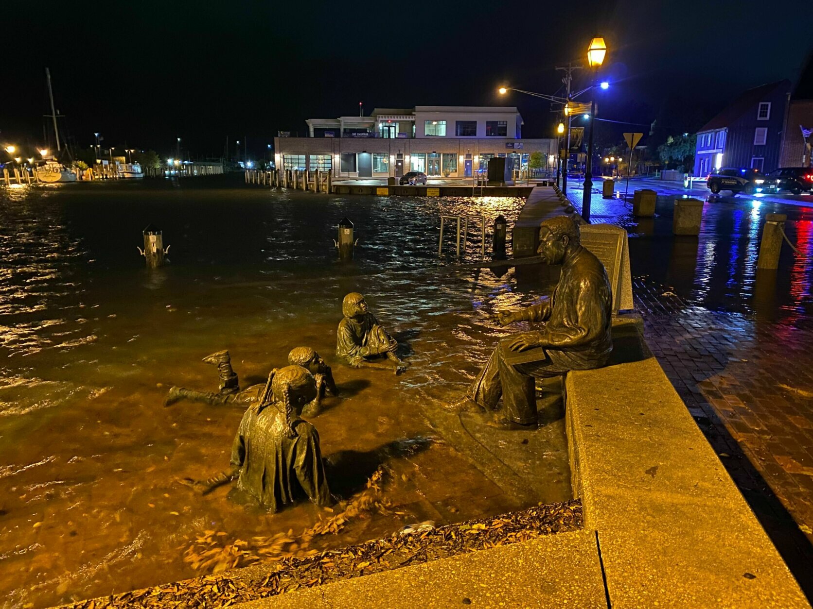
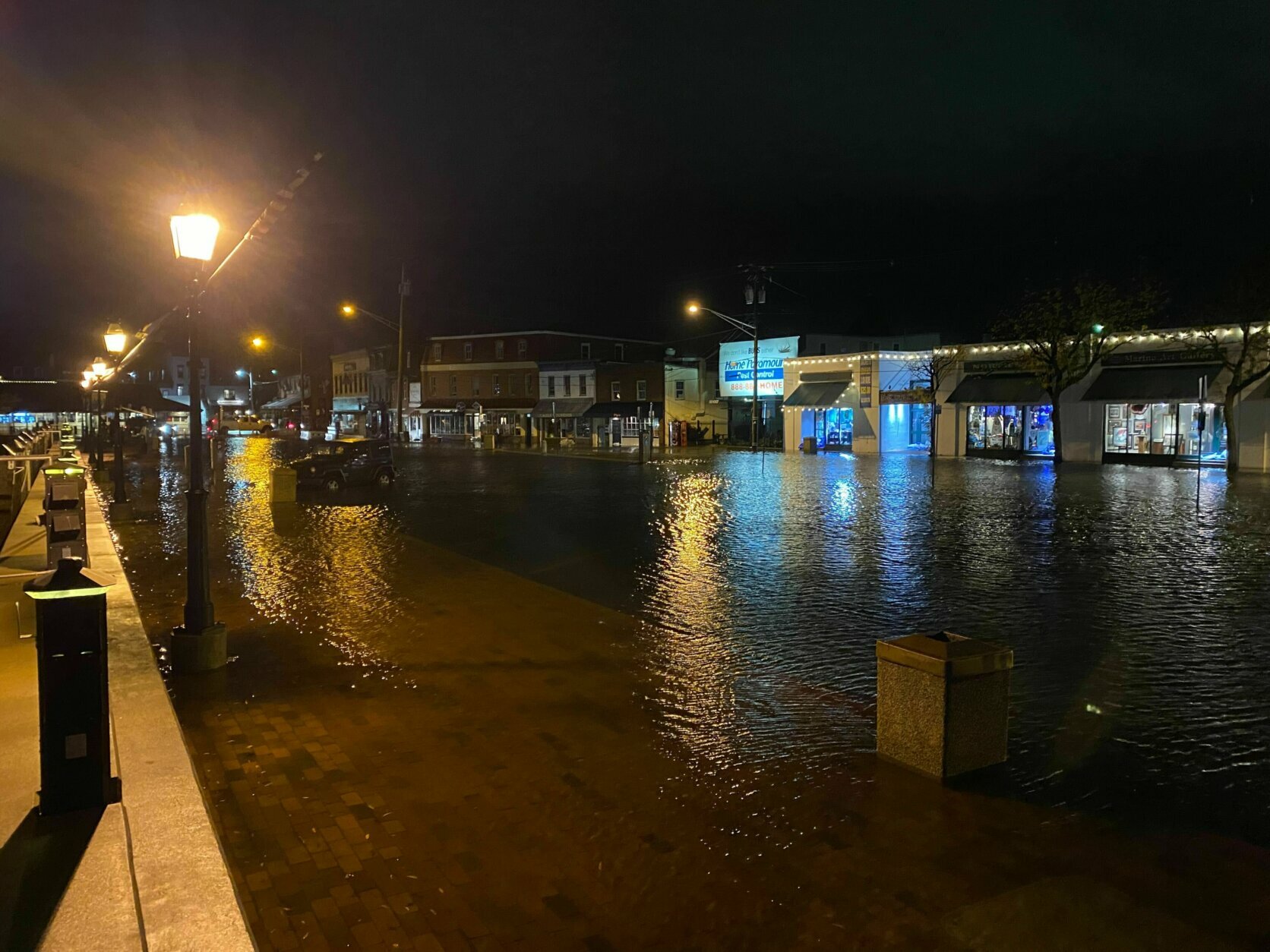
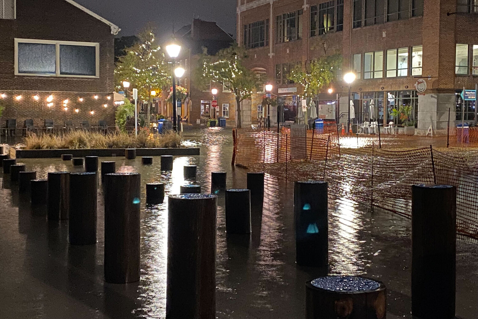
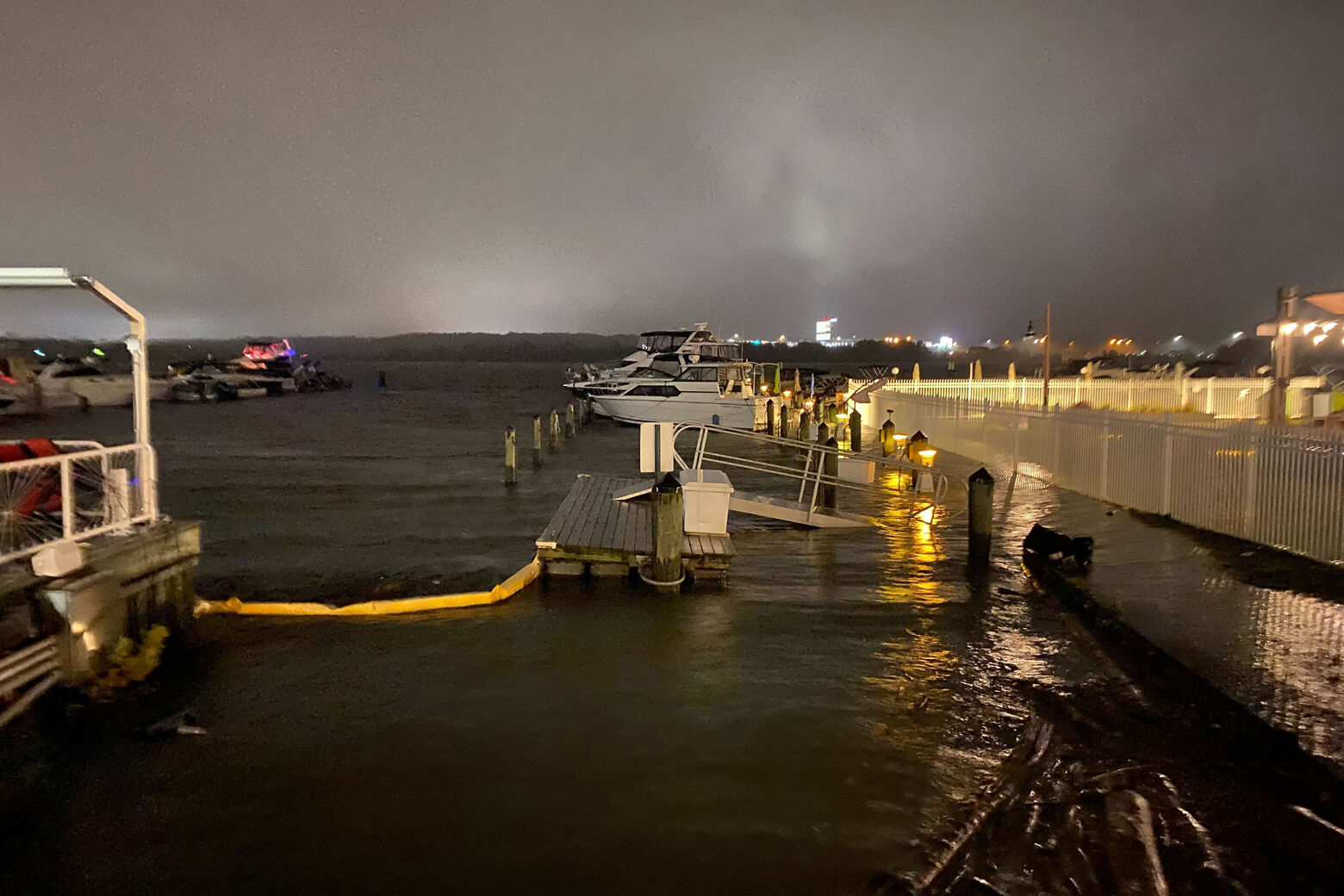
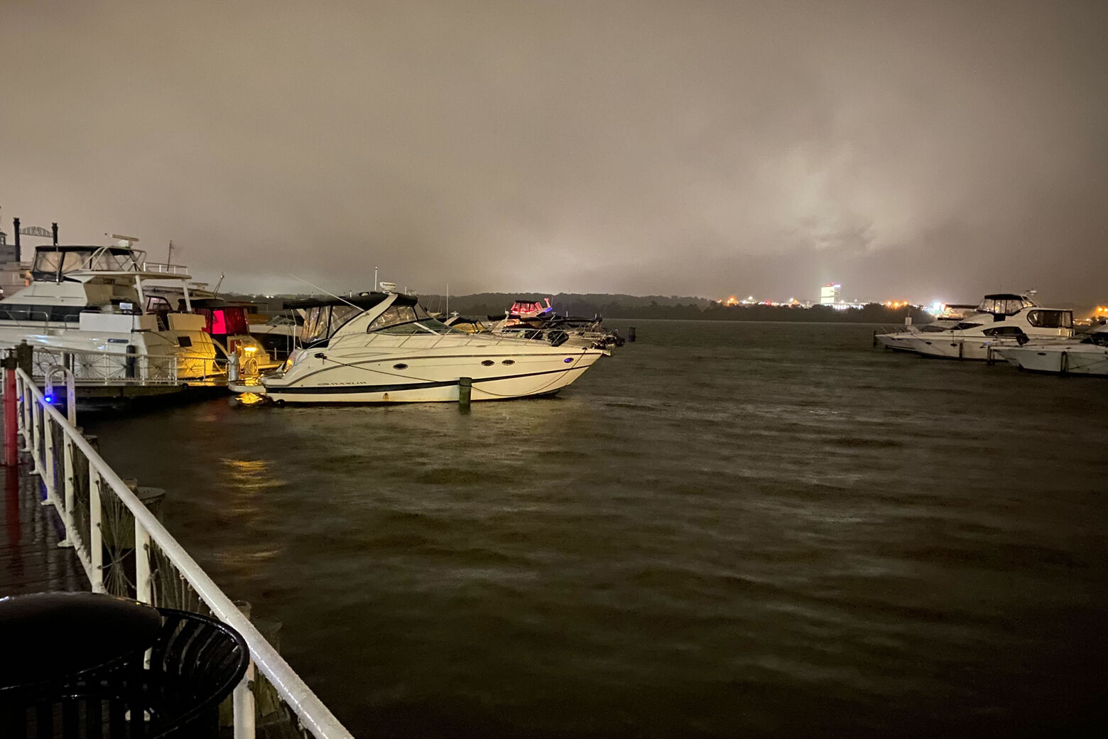
Areas of Old Town Alexandria in Virginia and Annapolis, Maryland, have been experiencing flooding at their waterfronts since 4 a.m.
It’s barely raining here in #Alexandria and already intersections are submerged, especially King St.
Can’t tell you how many rats I saw fleeing when I walked around the waterfront. @WTOP pic.twitter.com/flqi44Mcka— lukelukertwtop (@lukelukertwtop) October 29, 2021
StormTeam 4 Meteorologist Mike Stinneford said at 5 a.m. that the first wave of the storm had rolled through the region, but that the “heart of the storm” would reach the region around 9 a.m. to 10 a.m.
His advice: “Leave early or work from home.”
Kyle Pallozzi, a meteorologist with the National Weather Service in Sterling, Virginia, said that the biggest weather hazard today is likely the “really exceptional coastal flooding event,” which started Friday morning and could last through Saturday night.
“This is going to be one of the bigger events that we’ve had in the past 10 to 20 years in our area,” Pallozzi said. “Really it’s probably going to be the highest water levels for many locations since Isabel, we’re not expecting it to reach that level, it should be lesser than that, but it’s still is a significant event.”
StormTeam 4 Chief Meteorologist Doug Kammerer said the storm could last through the early part of the afternoon, possibly through rush hour traffic, before it leaves the area.
The latest radar imagery shows the initial bands of light showers moving northward into central VA as well as the Shenandoah Valley and Alleghenies. All of this activity will continue to move northward tonight. Rainfall becomes heavier on Friday. #MDwx #VAwx #DCwx #WVwx pic.twitter.com/7m6ah1dV59
— NWS Baltimore-Washington (@NWS_BaltWash) October 29, 2021
However, winds and flooding are bigger concerns with this storm system, Kammerer said. A high wind warning is in effect for Calvert and St. Mary’s counties in Maryland, with wind gusts expected to trend upwards of 50 to 60 mph. Parts of the District could experience 30 to 40 mph winds as well.
Meanwhile, Prince George’s County in Maryland and Arlington, Alexandria, Fairfax, Prince William and Stafford counties in Virginia are under a coastal flood warning until Saturday morning. Due to the high tide on the coast, the weather service said the storms could bring some of the worst coastal floods since Hurricane Isabel in 2003.
Winds, heavy rain lead to flooding
Kammerer said the coastal floods are caused by the strong southeast winds coming up with the storm system.
Stinneford said the water levels from the floods could be 1 to 4 feet high.
One of the biggest tidal flood events of the past 10-20 years (possibly since Hurricane Isabel at some locales), is expected Friday & Saturday. Those along tidal shores should get ready for exceptional tidal inundation! Tidal forecasts here: https://t.co/Q2WdpDGgIJ pic.twitter.com/LQkL80pzQs
— NWS Baltimore-Washington (@NWS_BaltWash) October 28, 2021
“All that does is bring the Atlantic Ocean into the Chesapeake Bay and then right up the Potomac River and does not allow the Potomac to evacuate into the Chesapeake,” Kammerer said. “You’ve got a buildup of water along the Bay, a buildup of water along the Potomac River as well. And that’s why we’ve already seen flooding over toward Georgetown and in parts of Alexandria as well.”
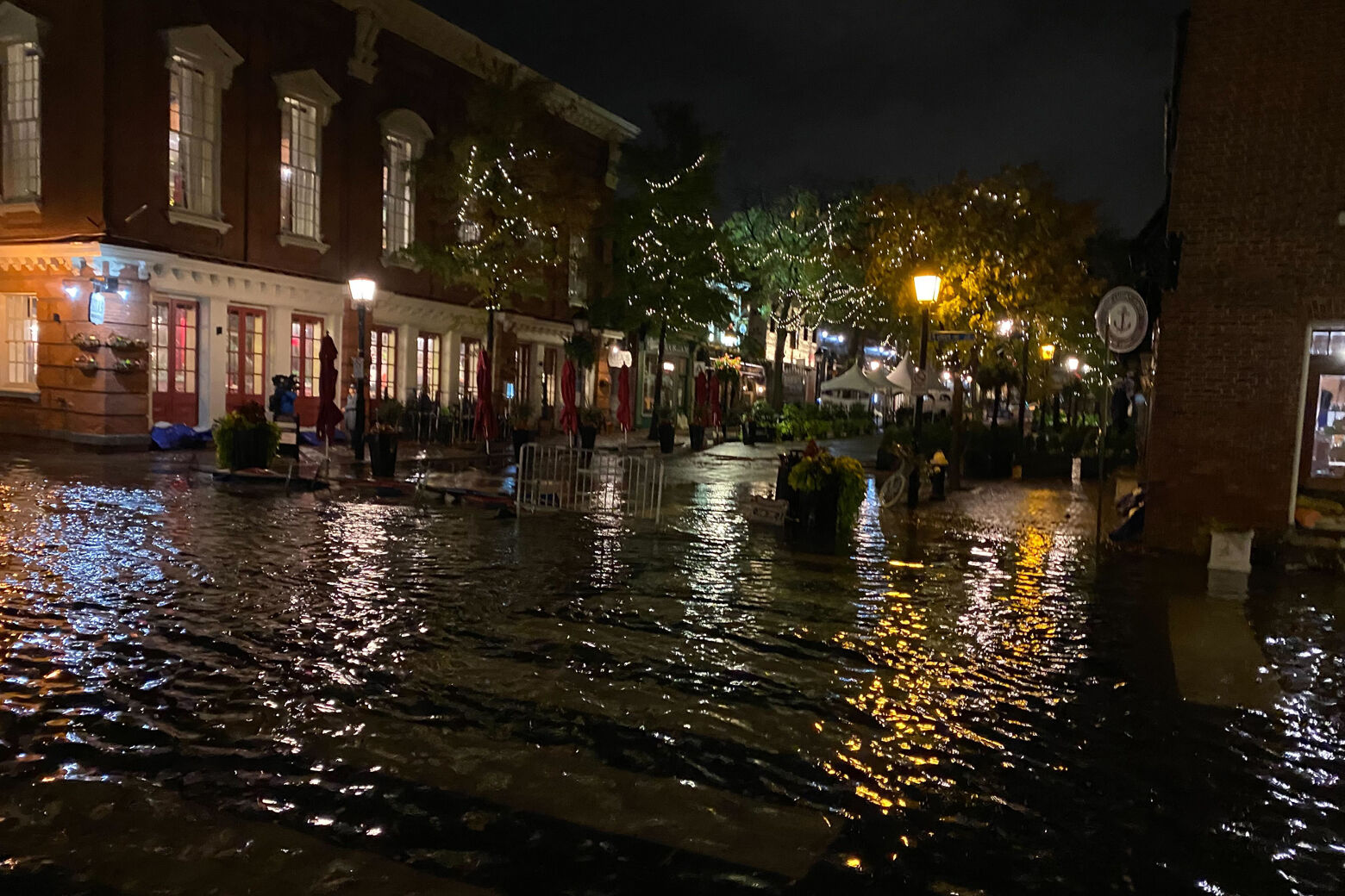
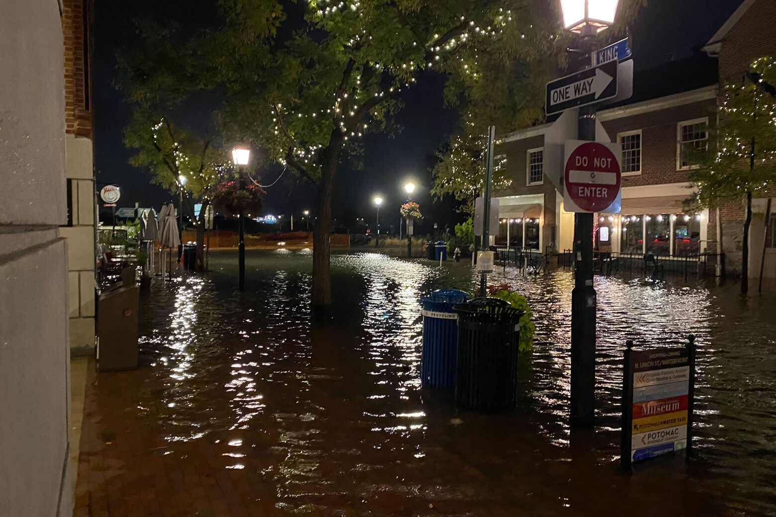
Be careful if you’re heading down to the Old Town waterfront. There is some flooding on King St., Prince St., Wales Alley & Strand St. Access to King St. & Prince St. is blocked at Union St.
Remember: Turn around, don’t drown! pic.twitter.com/S0dqVzSS2M
— Alexandria Police (@AlexandriaVAPD) October 28, 2021
WTOP’s Neal Augenstein reports that flood walls are up at Georgetown’s waterfront.
The flood walls are up on the Georgetown waterfront. The Potomac is still below dock level this morning. Stay w @WTOP as tidal flooding through area expected to increase. pic.twitter.com/l2siX9TuVf
— Neal Augenstein (@AugensteinWTOP) October 29, 2021
As of 7 a.m., “the Potomac is still below the dock level with a tidal surge that will likely change as the wind and rain continued to increase,” Augenstein said.
Storms will move out Saturday, although clouds, wind and some passing showers will remain. On Sunday, though, the sunshine returns for Halloween, with afternoon highs in the mid-60s.
Forecast:
- Friday: Rain, heavy at times. Rainfall between 1-2 inches. Windy with coastal flooding. Highs in the upper 50s to low 60s.
- Friday Night: cloudy and breezy with steady rain early in the evening. Lows in the 50s.
- Saturday: Mostly cloudy. Breezy and cooler. A few scattered showers or drizzle. Highs in the upper 50s to mid 60s.
- Sunday: Mostly cloudy early then gradual clearing late in the day. Sunny but breezy afternoon. Highs in the low to mid 60s.
- Monday: Sunny and seasonable. Steady breeze. Highs in the low to mid 60s.
Current conditions:
WTOP’s Colleen Kelleher and Anna Gawel contributed to this story.
"bring" - Google News
October 29, 2021 at 05:55PM
https://ift.tt/3bluNCm
Storm could bring DC area worst coastal flooding in 18 years - WTOP
"bring" - Google News
https://ift.tt/38Bquje
Shoes Man Tutorial
Pos News Update
Meme Update
Korean Entertainment News
Japan News Update
Bagikan Berita Ini


Related Posts :
 Group rallying to bring awareness to Israeli-Palestinian conflict - Wink News
- A repeat of the massive 1912 Novarupta eruption in Alaska could bring much of the world to a standstill - Anchorage Daily News
- Let's work to bring us together as a whole nation - Times-Enterprise
- Warmer weather expected to bring more bugs this summer - WWLP.com
- Sadelle's to Bring New York Restaurant Classics and High-End Market to 1212 Lincoln Road - RE:MiamiBeach
0 Response to "Storm could bring DC area worst coastal flooding in 18 years - WTOP"
Post a Comment